
These two images, provided by UNOSAT show the immense scale of the destruction brought about by the fighting.
 “This map illustrates satellite-detected areas of destruction in the town of Bor as seen by the WorldView-1 satellite on 19 January 2014. UNOSAT identified a total of 1,962 destroyed residential and related structures and a total of 93 warehouse or commercial structures were identified throughout the area analyzed, with the heaviest damage in the downtown area of government buildings.
The destroyed structures comprise an estimated 8.4% of the total number of pre-conflict structures in Bor. This analysis covers only the period from 25 December 2013 to 19 January 2014 and damage occurring before that time may not have been identified.”

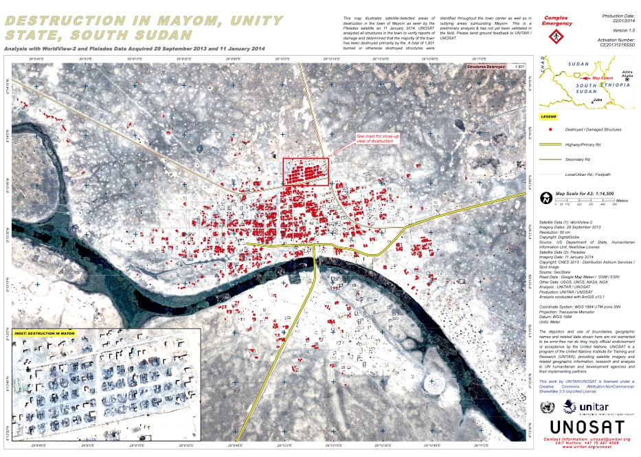
“This map illustrates satellite-detected areas of destruction in the town of Mayom as seen by the Pleiades satellite on 11 January 2014. UNOSAT analyzed all structures in the town to verify reports of damage and determined that the majority of the town has been destroyed primarily by fire.
A total of 1,801 burned or otherwise destroyed structures were identified throughout the town center as well as in outlying areas surrounding Mayom.”
There is plenty more information on the UNOSAT website about the impact of the fighting in South Sudan.
