By Jan Nyssen
The Ethiopia Insight article seems to attract readers and comments on social media.
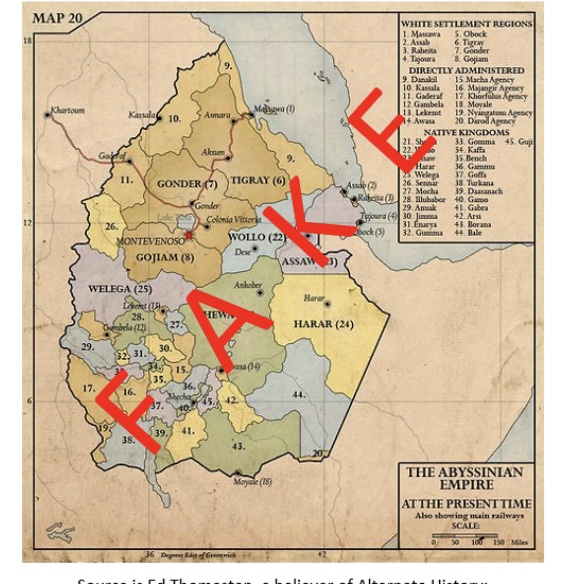
In the replies, not only maps are being posted out of context; there are also fake maps popping up. I just discovered one, that you may have seen already. This map is often posted on social media as evidence that the Gonder-Tigray border has been on Tekeze since the time of the Abyssinian empire. The map shows numerous flaws. See non-existent “white settlement regions”, “Montevenoso”, “Colonia Vittoria”, railways and encroachment onto Sudan and Djibouti. The map is fake; it was created in 2009.
Source is Ed Thomasten, a believer of Alternate History: https://www.deviantart.com/edthomasten/art/Empire-of-Abyssinia-c-1940-145811981
See a full set of “alternate maps” created by Thomasten: https://www.deviantart.com/edthomasten/gallery/23301342/maps?page=2
Colleagues fake mappers discuss the creation here:https://www.deviantart.com/edthomasten/art/Empire-of-Abyssinia-c-1940-145811981
