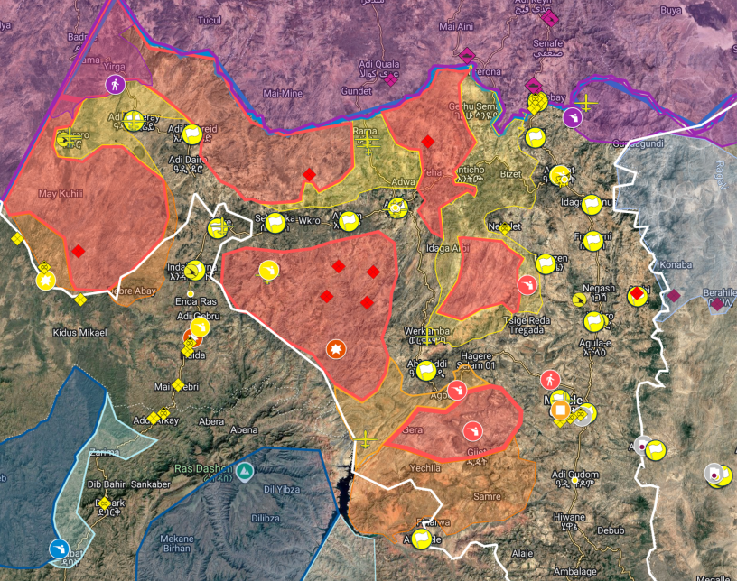
The war that broke out on 23nd of September 2026 is complex and difficult to read. There had been previous drone attacks and clashes, but this was on a much larger scale.
Areas come under attack, towns are taken and lost. Many groups are now involved. Several good maps have been published. Here are some which are useful. I am gradually adding to them.
Martin
Date: 16 October 2026
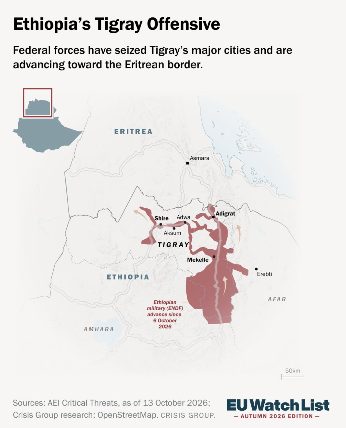
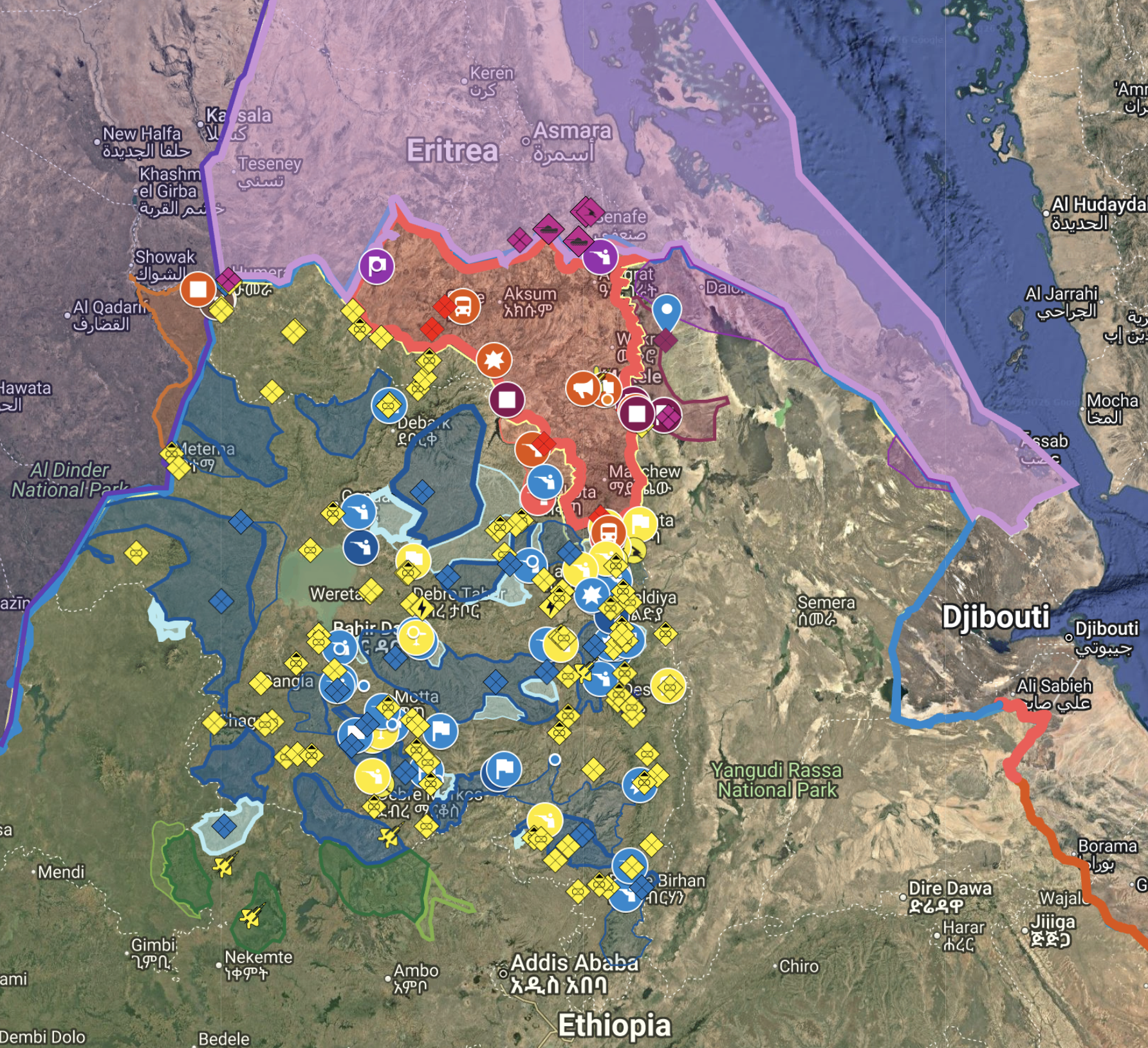
The Ethiopian Conflict Map @Ethiomapping – three maps. TDF in red,
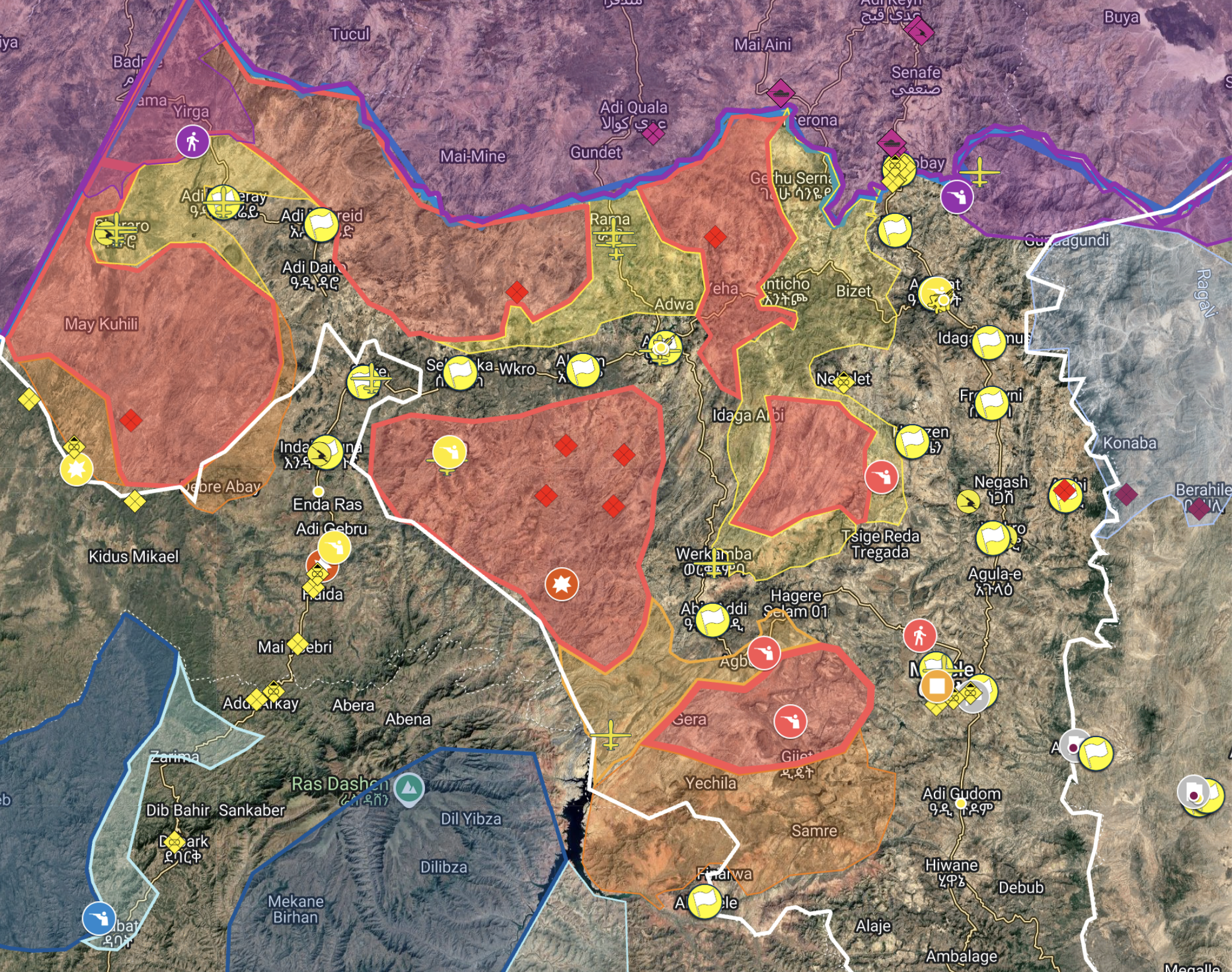
Below is also from Ethiopian Conflict Map @Ethiomapping.
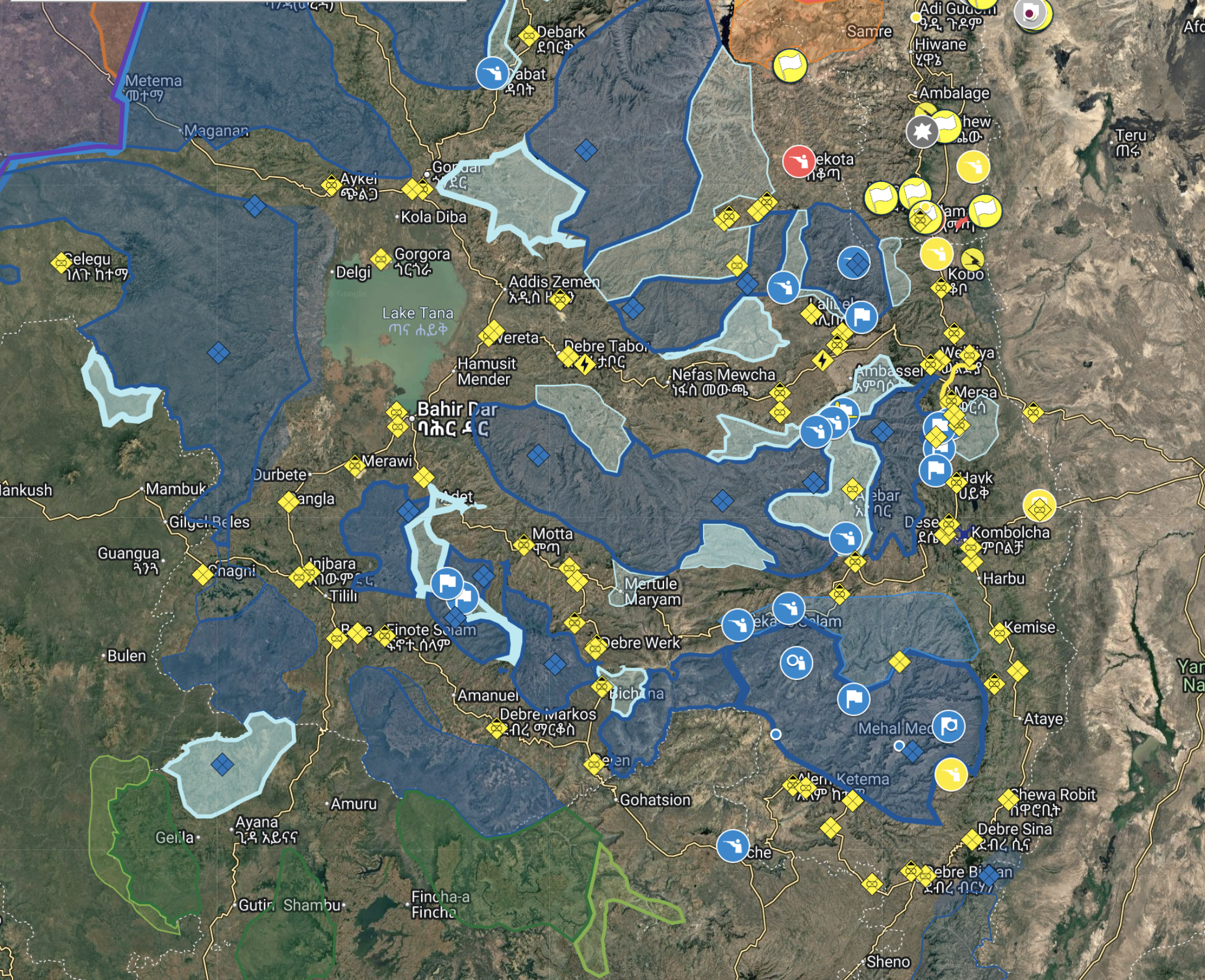
The fighting shown outside Tigray is important and often overlooked
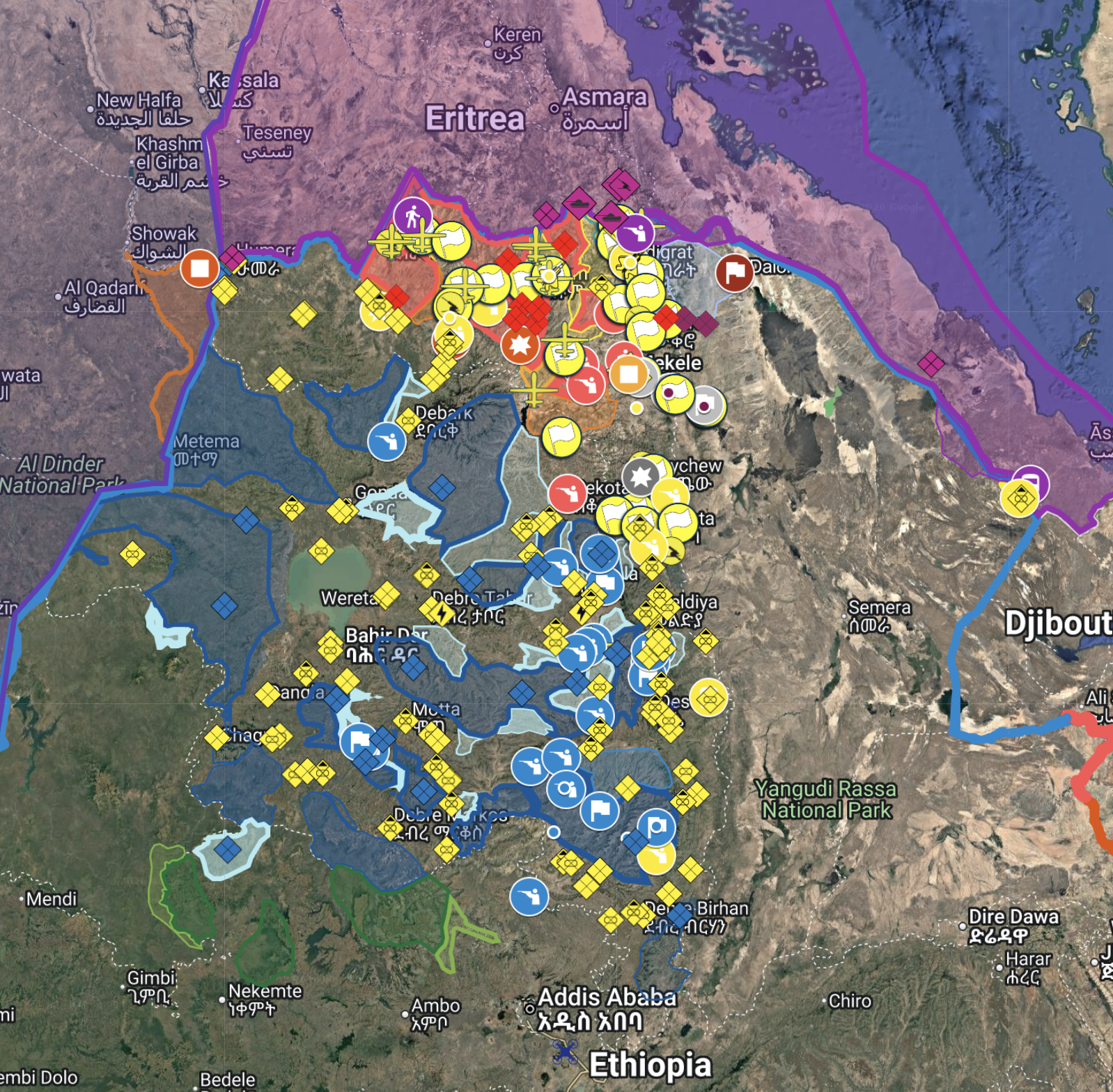
Below is also from Ethiopian Conflict Map @Ethiomapping. Fano in blue, OLA in green
Date: 13 October 2026
The Ethiopian Conflict Map @Ethiomapping
Detailed and allows for zooming in
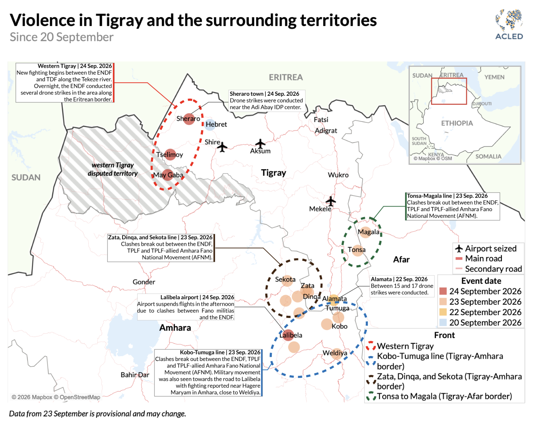
ACLED produces excellent maps which they have updated
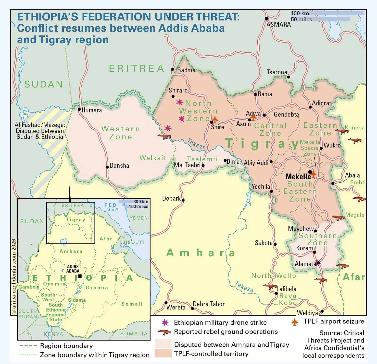
Africa Confidential Ethiopia war map 26 September 2026 is also clear and well presented
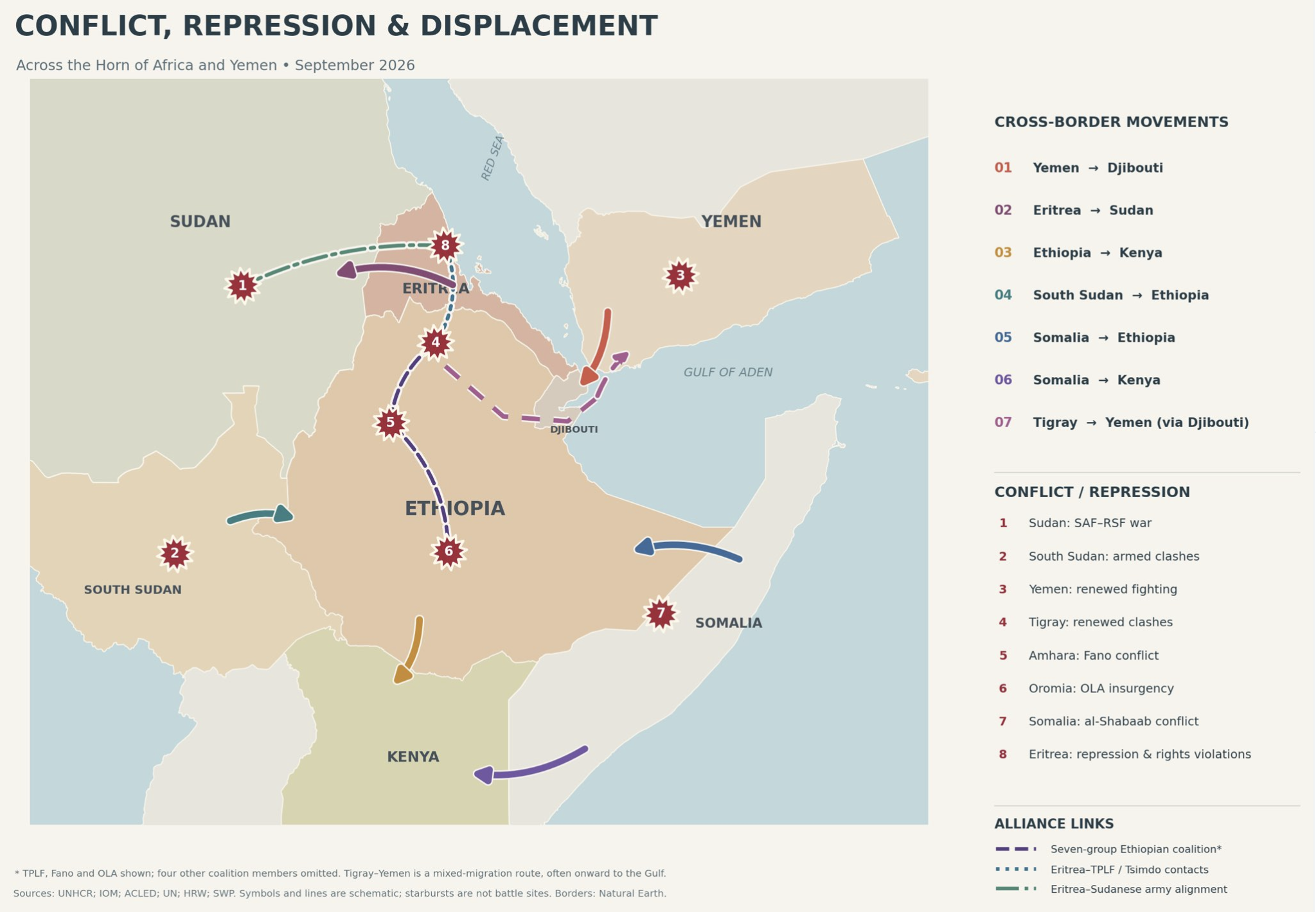
A helpful contextual map
Critical Threat 2 September 2026
The Ethiopian military (ENDF) has largely repelled the rebel offensive in northern Ethiopia and launched a counteroffensive along three axes toward the TPLF–controlled Tigrayan regional capital, Mekele.
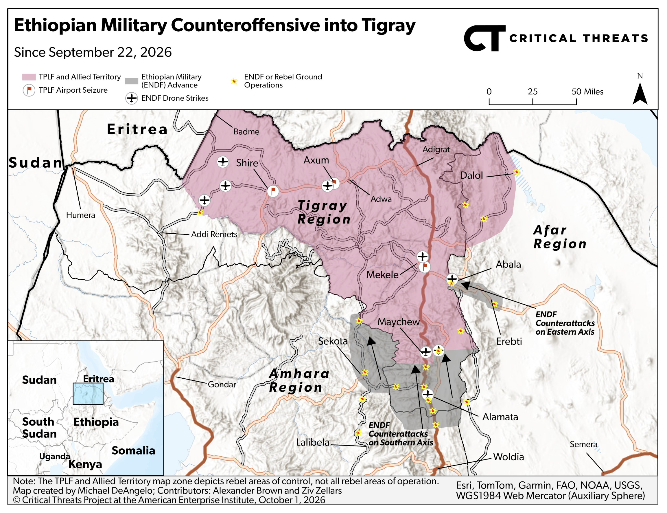
The Alliance for Survival rebel coalition has simultaneously launched a drone strike campaign across Ethiopia, including the capital, Addis Ababa, to degrade and stretch Ethiopian forces and demonstrate its ability to expand the conflict across the country.


Ethiopia has always been a land of PEACE since the time of President/ King Haile Seilacea, aka Lion of Judah! Please let’s keep Ethiopia PEACEFUL, PLEASE! It is SURELY PEACE Ethiopia; it is PEACE AFRICA! It is PEACE to the whole world! # Luke 2:14
God BLESS the Pope!
ethiopia has always been peaceful but since President Abiy Ahmed has been elected the country has fallen.
Ethiopia is in War, Because of their Prime minister Abiy Ahmed Ali. They should probably change their president and let the TPLF lead the country.
all Ethiopia united and support president Abiy Ahmed. all this terrorist and militia failed in election and choose gun to rule over people who not choose them! people are happy government finish the job! ethiopia should become republic with provinces and we no longer need federation, we are one country!
Ethiopia has never been awake of its dreams, slept off in dark since its existence.
Help! Help! Help Ethiopia awake of its dreams and live the actual life, lets protect Ethiopia from reliance on the kindness of others, let support Ethiopia to Lives without charity.
It seems like everybody is going for each other’s neck in Ethiopia. While the country fractures under the weight of internal war and crushing IMF debt, the Prosperity Government is busy building glamorous roads just to look good for an iShowSpeed YouTube video. Behind that shiny urban facade, the local currency has tanked, basic food and fuel are becoming unaffordable, and brutal regional conflicts are tearing the nation apart. It’s devastating to see a government prioritize a cosmetic PR campaign for global influencers while ordinary citizens bear the true cost of instability and austerity.